Cruising
Intracoastal Waterway Guide for Yacht Owners
A practical Intracoastal Waterway guide for owners running the Atlantic or Gulf ICW, covering boat fit, draft and air draft limits, seasonal timing, shoaling, bridges, locks, etiquette and when to go outside.
On this page
- The Ditch in plain terms
- Will your boat fit? Air draft, draft and beam
- How the route changes from Virginia to Miami
- Timing the snowbird migration
- Yellow triangles, yellow squares and staying in the channel
- Bridges, locks and the art of the hail
- Wake, the slow pass and Florida rules
- When to go outside
- The Gulf route and crossing Florida
- Marinas, anchorages and daily logistics
- FAQ
The Ditch in plain terms
The Intracoastal Waterway is a federally maintained chain of rivers, sounds, bays and man-made cuts that lets boats travel the Atlantic and Gulf coasts without going offshore. Cruisers call it the Ditch. In total it covers about 3,000 miles, and the U.S. Army Corps of Engineers maintains the channel, the dredging and the federal locks.
For a yacht owner the system splits into two very different waterways. The Atlantic ICW (AICW) starts at mile 0 in the Norfolk and Portsmouth area of Virginia and runs south through North Carolina, South Carolina, Georgia and down the east coast of Florida toward Miami and the Keys, with Key West at about mile 1,240. The Gulf Intracoastal Waterway (GIWW) runs from the Florida Panhandle to Brownsville, Texas, and is mainly a working route for tugs and barges. A separate protected section runs down Florida's west coast from the Tarpon Springs area to Fort Myers.
Mileage on the Atlantic side is measured in statute miles south from Norfolk, and every chart, guidebook and marina listing uses those mile markers. On the Gulf side, distances are measured in statute miles east and west of Harvey Lock in New Orleans. Learning to think in statute miles saves confusion, because your plotter speed is in knots and the waterway is not.
Will your boat fit? Air draft, draft and beam
The single most important number is air draft, the height from the waterline to the highest fixed point on the boat, including antennas, radar domes, anchor lights and outriggers. The Atlantic ICW was built with 65-foot fixed bridges as the standard, so anything over about 63 feet needs either another route or offshore legs. Sailboat owners with 64-foot masts measure precisely and watch tide boards at each bridge, because high water can steal a foot or two.
There are exceptions. The Julia Tuttle Causeway in Miami has a vertical clearance of about 56 feet, so taller sailboats run outside between Fort Lauderdale and Miami. Across Florida, the Okeechobee Waterway's Port Mayaca railroad bridge limits boats to roughly 49 feet. Some older bridges in specific areas are lower, which is why current guidebook clearances matter more than memory.
Draft is negotiable but not forgiving. The Corps' authorized depth is 12 feet along most of the Atlantic route north of Fort Pierce, but authorized does not mean maintained. Shoaling in Georgia and South Carolina regularly leaves sections well below that at low water. Boats drawing 4 to 5 feet barely notice. At 6 feet you run the trouble spots on a rising tide. At 7 feet the inside route becomes a series of calculated risks.
| Boat profile | Typical air draft | Typical draft | ICW fit |
|---|---|---|---|
| Trawler, 36 to 48 ft | 18 to 28 ft with mast down | 3.5 to 5 ft | Excellent, the classic ICW boat |
| Flybridge motor yacht, 45 to 65 ft | 18 to 26 ft | 3.5 to 5 ft | Excellent, watch wake in no-wake zones |
| Center console, 30 to 42 ft | 9 to 13 ft | 2 to 3 ft | Excellent, but rough open sounds can be wet |
| Cruising sailboat, 38 to 45 ft | 55 to 64 ft | 5 to 6.5 ft | Workable with exact mast height and tide planning |
| Sailing catamaran, 40 to 50 ft | 60 to 75 ft | 4 to 5 ft | Mast height often forces outside legs, beam limits marina slips |
| Deep-keel bluewater sloop | 60 ft plus | 6.5 to 7.5 ft | Hard work, most owners go offshore |
How the route changes from Virginia to Miami
Each state has its own personality, and planning by section is easier than planning by total miles.
North Carolina is a mix of wide, shallow sounds and narrow land cuts. Albemarle and Pamlico Sounds can build a steep, short chop in a 20-knot breeze because the water is so shallow. South Carolina brings the Waccamaw River's cypress swamps, the Rock Pile near Myrtle Beach with its hard ledges along the cut, and the big-tide marshes of the Lowcountry. Georgia is beautiful and notorious for shoaling. Florida's east coast turns into a long, narrow, heavily developed canal with dozens of opening bridges and stretches of slow-speed zones.
| Section | Approx. ICW miles | What to expect | Watch for |
|---|---|---|---|
| Norfolk to Albemarle Sound, VA and NC | 0 to 80 | Choice of the Virginia Cut or the Dismal Swamp Canal | Great Bridge lock, opening bridges, debris in the Dismal Swamp |
| NC sounds and cuts | 80 to 340 | Open sounds, Alligator River, Pungo canal, Beaufort | Short steep chop, side-setting currents near inlets |
| South Carolina | 340 to 575 | Waccamaw River, Charleston, Lowcountry marsh | Rock Pile ledges, shoaling near inlets, strong tidal current |
| Georgia | 575 to 715 | Remote marsh, big tidal range | Shoaling at well-known trouble spots, 7 to 9 ft tides |
| Northeast Florida | 715 to 900 | St. Johns River crossing, St. Augustine, Matanzas | Matanzas Inlet shoaling, bridge schedules |
| Central and South Florida | 900 to 1,090 | Indian River, Lake Worth, Fort Lauderdale, Miami | Manatee zones, restricted bridge openings, heavy weekend traffic |
Timing the snowbird migration
The fall run south usually builds through October and peaks in early November. Many boats stage around the Chesapeake after the October boat shows, then push south once the main hurricane threat eases. Insurance often drives the calendar more than weather. Many yacht policies carry a named-storm or navigation clause that requires the boat to be north or south of a certain latitude until a set date, so read yours before choosing a departure day.
The spring return runs from late March through May. Spring brings stronger winds on the open sounds and more fronts, but longer days. Summer travel is quieter, though heat, thunderstorms and hurricane risk keep most owners away.
Budget time honestly. A trawler averaging 7 to 8 knots typically covers 50 to 70 statute miles on a good day. Norfolk to South Florida is commonly done in three to five weeks with weather days and a few lay days in places such as Beaufort, Charleston, Savannah and St. Augustine. A fast motor yacht can do it in a week, but the ICW punishes schedules, so leave slack.
Yellow triangles, yellow squares and staying in the channel
ICW aids to navigation carry a small yellow symbol that tells you which side to pass when following the waterway. A yellow triangle means keep the mark on your starboard side when headed south on the Atlantic ICW (or west on the Gulf), and a yellow square means keep it to port. This matters most where the ICW crosses an inlet or shares a river channel, because the underlying red and green marks follow that channel's own convention. When the colors and the yellow symbol disagree, follow the yellow symbol for the ICW.
Charts lag reality. Shoals migrate, the Coast Guard moves buoys, and dredging changes depths overnight. Experienced cruisers combine three sources before every leg: current electronic charts, Army Corps hydrographic survey data for known problem areas, and crowd-sourced notes from apps such as ActiveCaptain or Aqua Map along with the Waterway Guide. Coast Guard Local Notices to Mariners list buoy changes and bridge work.
- Stay in the middle of narrow land cuts, and favor the outside of bends where the current scours deeper water.
- Expect shoaling where inlets cross the waterway, since tidal flow drops sand right into the channel.
- Run the known skinny spots on a rising tide, two to three hours after low, so a soft grounding floats off quickly.
Bridges, locks and the art of the hail
Opening bridges set the pace of an ICW day, especially in Florida. Some open on demand, others on the hour and half hour, and some are closed during weekday rush hours. Schedules change with construction, so check the Coast Pilot and Local Notices rather than an old guidebook. Bridge tenders are normally hailed on VHF, commonly channel 9 in most of the Southeast and channel 13 farther north, and posted signs at each bridge confirm the channel and schedule.
When you call, give the bridge name, your vessel name and type, direction of travel and your request. Arrive a few minutes early, hold station well clear, and do not crowd the opening. Faster boats are often asked to go through first. If several bridges are a few miles apart on fixed schedules, run them at a speed that makes the next opening rather than racing and waiting.
Locks are few on the Atlantic route. The Great Bridge lock on the Virginia Cut is the first most southbound boats meet, with only a small change in level. The Dismal Swamp Canal alternative has locks at Deep Creek and South Mills and a controlling depth often cited around 6 feet, plus submerged logs that bend propellers, so it suits shallow, slow boats. The Gulf route has more locks around New Orleans and in Louisiana, where pleasure craft wait behind commercial tows.
Wake, the slow pass and Florida rules
Under federal and state law, you are responsible for damage caused by your wake. That covers docks, moored boats and people working on the shoreline. Most ICW friction comes from passing, and there is a well-understood routine. The overtaking boat calls the slower boat on VHF, asks for a slow pass and says which side. The slower boat throttles back to idle, the faster boat comes off plane and passes at minimum wake, then both resume speed. Done right it costs each boat a couple of minutes.
Florida adds layers. Seasonal and year-round manatee protection zones require idle speed or slow speed in posted areas, and enforcement is real. Some South Florida areas have anchoring limitation zones that restrict overnight anchoring near certain residential neighborhoods. Read local signage and the latest guidebook notes before dropping the hook in Miami-Dade, Broward or Monroe County waters.
- Slow down well before marinas, fuel docks, bridges and anchorages, not as you pass them.
- Check behind you, since a 50-foot motor yacht at semi-displacement speed throws the largest wake of any speed.
- Monitor channel 16 plus 13 or the local bridge channel underway, because commercial tows and other boats coordinate there.
- Give tugs and barges in narrow cuts all the room they ask for and talk to them early.
When to go outside
One of the best ICW skills is knowing when not to use it. On a settled day with a light offshore breeze, an outside run between two good inlets can save a full day of bridges and shoals. The trade-off is commitment, since inlets with breaking bars become dangerous when wind opposes an ebb tide.
Pick inlets with a deep, maintained, well-marked entrance that commercial and military traffic use. Cruisers routinely use Beaufort Inlet in North Carolina, Charleston Harbor, the Savannah River entrance, St. Marys at Fernandina, Port Canaveral, Fort Pierce, Lake Worth and Port Everglades. Smaller inlets with shifting bars are local knowledge only.
| Outside leg | Typical reason to go outside | Key consideration |
|---|---|---|
| Beaufort NC to Charleston | Skips the Cape Fear shoals and the Rock Pile | Overnight run for slow boats, round Frying Pan Shoals well offshore |
| Charleston to St. Marys | Skips Georgia's shoaling and twisty marsh | Long day or overnight, Gulf Stream weather matters |
| Fort Pierce to Lake Worth | Avoids slow zones and many bridges | Short, easy daytime leg in calm conditions |
| Lake Worth to Port Everglades or Miami | Avoids dozens of bridges | Required for masts above 56 ft south of Fort Lauderdale |
The Gulf route and crossing Florida
The Gulf Intracoastal Waterway is first and foremost a commercial artery for petroleum and chemicals, with long tows of barges that cannot stop or turn quickly. Yacht facilities thin out in Louisiana and parts of Texas, so plan fuel stops carefully.
Between the Panhandle and the Tarpon Springs area there is no protected route. The Big Bend coast of Florida is shallow for miles offshore, so boats either make one overnight crossing of the open Gulf or hop along the coast using shallow ports in good weather. Great Loop boats deal with this crossing every year, and it deserves the same respect as any offshore passage.
The Okeechobee Waterway crosses the Florida peninsula from Stuart on the east coast to Fort Myers on the west, through Lake Okeechobee and a series of locks. The 49-foot railroad bridge at Port Mayaca and lake level, which affects controlling depth, decide whether it works for your boat. When the lake is low, deeper boats go around the Keys instead.
Marinas, anchorages and daily logistics
Most yacht owners on the ICW mix marinas and anchorages. Popular marinas in towns such as Beaufort, Charleston, St. Augustine and Vero Beach fill up during the migration peaks, so reserve a day or two ahead in season. Transient rates are charged per foot per night plus electricity, and they vary widely by region and season, so check current rates rather than assuming last year's.
Anchorages are plentiful in the Carolinas and Georgia, but tidal current in the Lowcountry is strong enough to swing a boat through 180 degrees twice a day. Use generous scope, a modern high-holding anchor and an anchor alarm, and leave room for boats that swing differently than yours. A dinghy with a reliable outboard turns remote anchorages into real stops.
- Measure true air draft with every antenna up and write it on the helm.
- Fuel up where volume is high, which usually means cleaner fuel and better prices.
- Carry spare impellers, filters, belts and a prop if your boat has exposed running gear, since debris and groundings happen.
- Download charts and guidebook data offline, because cell coverage disappears in parts of Georgia and the NC sounds.
- Plan pump-out stops, since much of the ICW lies in no-discharge waters.
- Join a towing service membership, since soft groundings on the ICW are a matter of when, not if.
Models mentioned in this guide
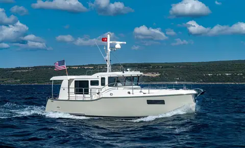
Nordhavn 41
Trawlers & Explorer Yachts, 41 ft
Used $1.15M to $1.75M
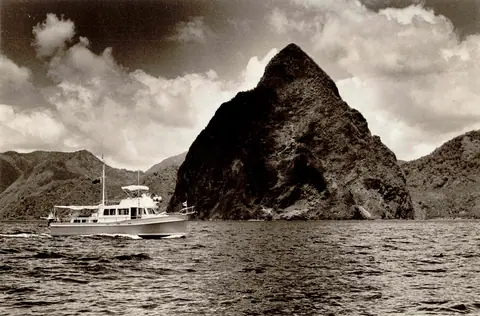
Grand Banks 42 Classic
Trawlers & Explorer Yachts, 43 ft
Used $75K to $360K
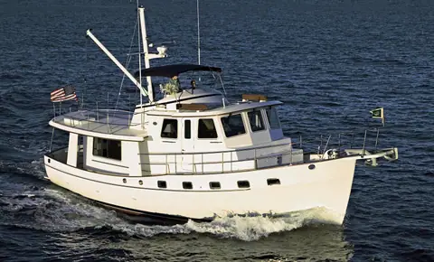
Kadey-Krogen 44 AE
Trawlers & Explorer Yachts, 49 ft
Used $650K to $1.1M
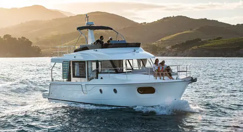
Beneteau Swift Trawler 41
Trawlers & Explorer Yachts, 44 ft
Used $450K to $760K
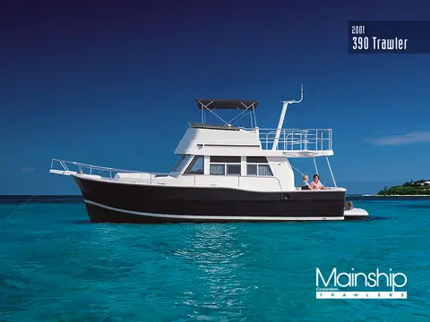
Mainship 390 Trawler
Trawlers & Explorer Yachts, 40 ft
Used $95K to $185K
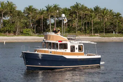
Ranger Tugs R-31
Trawlers & Explorer Yachts, 35 ft
Used $230K to $470K
Frequently asked questions
How long is the Intracoastal Waterway?
The whole system is about 3,000 miles. The Atlantic section runs from Norfolk, Virginia to Florida, with Key West around mile 1,240, and the Gulf section runs from the Florida Panhandle to Brownsville, Texas.
What is the bridge clearance on the Intracoastal Waterway?
Most fixed bridges on the Atlantic ICW are built to 65 feet of vertical clearance at normal high water. A few are lower, notably the Julia Tuttle Causeway in Miami at about 56 feet, so always confirm clearances for your route.
How deep is the Intracoastal Waterway?
The authorized depth along most of the Atlantic route is 12 feet, but shoaling leaves some sections much shallower at low tide. Boats drawing 5 feet or less travel comfortably, while deeper boats plan around tides.
How long does it take to run the ICW from Norfolk to Florida?
A trawler at 7 to 8 knots usually takes three to five weeks including weather and rest days. A fast motor yacht can do it in about a week if bridges and weather cooperate.
Do you need a license to boat on the Intracoastal Waterway?
No federal license is needed to operate your own recreational boat, but most states require a boater education card for certain ages, and Florida enforces its rules actively.
Can a sailboat do the ICW?
Yes, thousands do each year. The limits are mast height under the 65-foot bridges and a draft that works with the tides, and many sailboats go outside for the legs where the inside route is slow or shallow.
Keep reading
The Great Loop, Route, Costs and Planning
A planning guide to America's Great Loop, the roughly 6,000 mile circuit of the eastern US and part of Canada, covering the…
CruisingBest Trawlers and Boats for the Great Loop
How to choose a Great Loop boat, with the hard limits every Looper boat must meet, our picks from budget Mainships to…
OwnershipYacht Insurance Guide, Costs and Coverage
A plain-English yacht insurance guide for US owners covering hull and liability coverage, agreed value versus actual cash value…
KnowledgeBoating Terminology, 150 Terms Every Owner Should Know
A themed glossary of boating terminology for new and experienced owners, grouped by hull, deck, lines, sails, engines…